몽골 아이막 상세 소개>-서몽골 바양-얼기 아이막 (Баян-Өлгий аймаг - Bayan-ulgii aimag) ![]() 나의 관심정보
나의 관심정보 ![]()
작성자: 비로자나(taegeukgi88)
![]() http://blog.naver.com/taegeukgi88/memo/100175244777
http://blog.naver.com/taegeukgi88/memo/100175244777
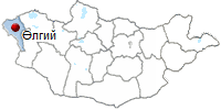
바양-얼기 아이막 (Баян-Өлгий аймаг - Bayan-ulgii aimag)
|
바양-얼기 아이막은 1940년도에 설립된 아이막이며 몽골의 극서부 지역 산맥 지대에 위치하고 있다. |
| 1. 알타이 2. 알탕처그츠 3. 바양노오르 4. 보가트 5. 볼강 6. 보얀트 7. 차강노오르 |
8. 델룽 9. 노공노오르 10. 사그세 11. 톨보 12. 올란호스 13. 쳉겔 |
얼기 시
얼기 시는 1940년에 설립된 시이며, 현재 인구는 24,000명이다. 올란바타르 수도에서 1,780km 떨어져 있다. 바양얼기 아이막에 몽골뿐만 아니라 세계에 유명한 높은 산들이 있다.
- 만년설 알타이 산맥의 타왕보그드산 (4653m)
- 멍흐 하이르항 산 ( 4,234m) - 참바가라브 산 (4,208m)
- 보가트 산(4,041m) - 바양엥게르 산(4,025m)
- 쳉겔하이르항 산(3,967m)
- 머스트 산 (3,934m) 등의 여러 산과 만년설에서 흐르는 얼음 강 타왕보그드가 17km에 걸쳐 흐르고 있다.
이외에 다양, 톨보, 호통, 호르공, 탈르 아치트 등의 산 사이에 위치하는 호수들이 있다. 호수의 원류를 이루는
강들은 하르 에르치스잉 에흐 호림트, 호브드, 볼강 등이다. 또한 바양얼기 아이막에는 차강, 인데르트, 라샨트,
시게르테라는 온천이 있다.
바양얼기 아이막의 주업은:
- 유목 (양, 염소, 소, 말, 낙타)
- 광산 (석탄)
- 채소 및 과일 제배
- 밀 농사
- 가축 털 세척 공장
지하자원: 석탄, 철광석, 비철금속, 구리, 강철, 흑연, 현석, 대리석, 석회암, 화강암, 수정, 황옥 등등
야생동물: 산양, 야생 염소, 수달, 발제비, 곰, 늑대, 여우, 표범, 멧돼지, 흰 토끼, 살쾡이, manul, 스컹크 등등
야생조류: 콘도르, 독수리, 불평, 뇌조, 꿩닭 등으로 풍부하다
주변여행지:
털버 호수:
몽골 알타이 산맥의 185㎢ 를 자치하는 고산지대의 호수이다. 넓이 10km, 길이 18km 로 수심이 10m 이다.
알타이 황어가 서식하기로 유명하다.
차강 강 (하얀 강): 타웡 복드 산의 만년설을 상 원류로 흘러가는 강으로 강의 색깔이 우유처럼 희다.
BAYAN-ULGII AIMAG.
- Territory - 17645 square miles (45,700 sq. km)
- Center - Ulgii town, located 1055 miles
(1,698 km) from Ulaanbaatar.
- Number of somons - 14
- Bayan-Ulgii aimag was established in 1940.
- Population - 100,000.

Called "the Roof of the World", Bayan-Ulgii is a far-off land of high mountains (the Mongol Altai - Tavan Bogd mountains with 4,373 m peak) torrents and glaciers, inhabited by Kazakh, a minority who has a different culture from the Mongols, herding yaks and goats and hunting with trained eagles.
 Bayan-Ulgii aimag is situated in the extreme West of Mongolia, on the West and North it borders with the Russian Federation and on the South-West with the People's Republic of China. The Nairamdal peak 14,350 feet (4374 m) of the Altai Tavan Bogd mountain is the highest point, Khovd, the biggest river (321 miles /516 km in length) in the country flows through the territory of the aimag. There are many fresh water lakes in Bayan-Ulgii. Tolbo and Dayan lakes are the largest. This aimag is well-known for Ak-su, Chigertei and other springs. Every part of Bayan-Ulgii aimag is suitable for pasture. Rich flora of Bayan-Ulgii includes kobresia, sedge in the mountain plateau, gooseberry and ribes altissimum, also wild cherry, and sea bucks can be found along the banks of streams and rivers. 10 percent of the area is forest, consisting mainly of larches. Geological surveys have proved that this territory contains fossils, ferrous and non-ferrous metals, oil and building material resources. There are wild sheep, ibex, and snow leopards in the Altai high mountain range and marmots, foxes inhabit the lower slopes of mountains. There are bears, lynxes, and squirrels in the forests. 80 percent of the population is Kazakh and 17 percent is Uriankhai. In 1998, Bayan-Ulgii aimag harvested over 3.000 tons of grain, 600 tons of forage, and 21.452 tons of potatoes and vegetables. The coal mine of Bayan-Ulgii aimag produces 404.000 tons of coal and it's trade turnover is over 166.7 million tugriks.
The Mongol Altai Nuruu is the backbone of Bayan-Olgii. The highest peaks, many over 4000m, are permanently covered with glaciers and snow, while the valleys have a few green pastures, which support about two million livestock, as well as bears, foxes and lynxes. These valleys are dotted with small communities of nomadic families enjoying the short summer from mid-June to late August, as well as some beautiful alpine lakes.
The ethnic groups who call Bayan-Olgii home are comprised of the Kazakh, Khalkh. Dorvod, Uriankhai, Tuva, and Khoshuud. Unlike the rest of Mongolia, which is dominated by the Khalkh Mongols. About 90% of Bayan-Olgii's population are Kazakh, almost all of them Muslim. The remaining 10% are mostly obscure minority groups.
Many people in the aimag speak Kazakh, so if you have spent time perfecting some conversational Mongolian, you may be devastated because many Kazakhs won't be able to understand you. There is bound to be someone nearby, however, who speaks Mongolian and, possibly Russian, but certainly nothing else.
The aimag has a rich collection of archaeological sites, with many balbal (Turkic stone figures believed to be grave makers), deer stones, kiirgans (burial mounds) and a remarkable collection of 10,000 petroglyphs near the Russian border at Tsagaan Sala (also known as Baga Oigor). If you are particularly interested in these remote and obscure sites contact the Mongol Altai Nuruu Special Protected Area office in Olgii.
PROTECTED AREAS IN BAYAN - ULGII AIMAG
Most of the parks come under the jurisdiction of the Mongol Altai Nuruu Special Protected Area. Environmentalists hope that further sections of Bayan-Olgii will become national parks to preserve the argali sheep, ibex and snow leopard, as well as the important sources of lakes and rivers in the Great Lakes depression in the Uvs and Khovd aimags.
- Altai Tavanbogd National Park (636,161 hectares). Takes in Tavanbogd Uul, Mongolia's highest mountain, and the stunning lakes of Khoton, Khurgan and Dayan. Fauna includes argali sheep, ibex, maral (Asiatic red deer), stone marten, deer, elk, Altai snowcock and eagles.
- Khokh Serkh Strictly Protected Area (65,920 hectare). A mountainous area on the border with Khovd, which protects argali sheep and ibex.
- Siylkhem Nuruu National Park (14,080 hectares). This new park, created in 2000, has two sections, one around Ikh Turgen Uul, the other further east.
- Develiin Aral Natural Reserve (10,300 hectares). A remarkable habitat around Develiin Island in the L'san Khooloi and Khovd rivers. Established in 2000, it is home to pheasants, boars and beavers.
- Tsambagarav L'ul National Park (110,960 hectares). Established in 2000 to protect glaciers and the snow leopard habitat borders on Khovd.
PLACES TO VISITED.
- Ulgii (Olgii). Elevation 1710m. Olgii, the capital of the aimag, is an ethnically Kazakh city that happens to be in Mongolia. You can certainly feel that you are in a Muslim-influenced Central Asian region, rather than in Mongolia: many places have squat toilets; in the city, there are signs in Arabic and Kazakh Cyrillic; the market, which is called a bazar rather than the Mongolian zakh, sells the odd kebab (shashlyk) and is stocked with goods from Kazakhstan. Olgii is 1645km from Ulaanbaator but only 225km from Russia.
Olgii is suffering from the outflow of Kazakhs to Kazakhstan following the break up of the Soviet Union. Olgii is the only aimag capital to have a serious decline in population: about 9000 Kazakhs left the city in 1992 and 1993. Many have since returned, disillusioned with life in the exSoviet republic and the population is rising once again.
The aimag museum gives an excellent of overview of Kazakh culture and of the geography of Bayan-Olgii. The 2nd floor is devoted to history, and the 3rd floor has some interesting displays; entry costs T 1000.
Olgii's mosque and madrasah (Islamic place of learning) is worth a quick look, especially on Friday at lunch time when weekly prayers are held, though you may not be allowed inside. The mosque holds the offices of the Islamic Centre of Mongolia. Its unusual angle is due to its orientation to Mecca.
- Tsagaannuur. Yet another place called Tsagaanuur (White Lake); the town is less famous for its lake (there are several bigger and nicer ones nearby) than as the starting point for travel by road into Russia.
- Tsast Uul. The two sums (districts) of Altantsogts and Bayannuur are about 50km south-east of Olgii, on the border with Khovd aimag. They are full of lush valleys with friendly Kazakh and Mongol nomads in summer, dozens of tiny unmapped lakes and soaring, permanently snowcapped peaks, such as Tsast Uul (4193m).
- Altay Tavanbogd Natural Park. This stunningly beautiful park stretches south from Tavanbogd Uul and includes the three stunning lakes of Khoton Nuur, Khurgan Nuur and Dayan Nuur. It's a remote area, divided from China by the high wall of snowcapped peaks, and known to local Kazakhs as the Syrgali region.
All three lakes are the source of the Khovd Gol, which eventually flows into Khar Us Nuur in Khovd aimag. It's possible to make rafting trips down river from Dayan Nuur, though no agencies offer this at present.
There are many archeological sites in the region. As the main road through the region swings towards the southern shore of Khurgan Nuur you can see a stupa-like construction and several burial sites. Nearby is a balbal (Turkic stone statue) and the remains of a processional pathway. Further along the road is a wooden Kazakh mosque, with a ger-shaped roof.
Further north-west, along the south-western shore of Khoton Nuur, the road deteriorates and there are several rivers to cross as they flow into the lake. North-west of Khoton Nuur the mountains close in and there's some fine trekking possibilities.
Tavanbogd (Five Saints) mountain rises 4374m above the borders of three nations, and for this reason it is also known as Nairamdal (Friendship) Peak. If you sit on the summit, you can simultaneously be in Mongolia, China and Russia (though you won't need a visa for all three).
Tavanbogd is one of Mongolia's most spectacular peaks, of interest to professional climbers, and the only one in Bavan-Olgii to be permanently covered with large glaciers (including the 19km long Potanii Glacier, the longest in Mongolia). It's fairly dangerous, and to climb it you need to be with an experienced group properly equipped with ice axes, crampons and ropes. Don't even consider attempting it solo. The best time to climb is August and September, after the worst of the summer rains.The massif is made up of five peaks (the five saints) - Khuiten, Naran, Olgii, Buraed and Nairamdal - the highest of which is Khuiten (meaning 'cold') at 4374m.
(1,698 km) from Ulaanbaatar.
Called "the Roof of the World", Bayan-Ulgii is a far-off land of high mountains (the Mongol Altai - Tavan Bogd mountains with 4,373 m peak) torrents and glaciers, inhabited by Kazakh, a minority who has a different culture from the Mongols, herding yaks and goats and hunting with trained eagles.
Bayan-Ulgii aimag is situated in the extreme West of Mongolia, on the West and North it borders with the Russian Federation and on the South-West with the People's Republic of China. The Nairamdal peak 14,350 feet (4374 m) of the Altai Tavan Bogd mountain is the highest point, Khovd, the biggest river (321 miles /516 km in length) in the country flows through the territory of the aimag. There are many fresh water lakes in Bayan-Ulgii. Tolbo and Dayan lakes are the largest. This aimag is well-known for Ak-su, Chigertei and other springs. Every part of Bayan-Ulgii aimag is suitable for pasture. Rich flora of Bayan-Ulgii includes kobresia, sedge in the mountain plateau, gooseberry and ribes altissimum, also wild cherry, and sea bucks can be found along the banks of streams and rivers. 10 percent of the area is forest, consisting mainly of larches. Geological surveys have proved that this territory contains fossils, ferrous and non-ferrous metals, oil and building material resources. There are wild sheep, ibex, and snow leopards in the Altai high mountain range and marmots, foxes inhabit the lower slopes of mountains. There are bears, lynxes, and squirrels in the forests. 80 percent of the population is Kazakh and 17 percent is Uriankhai. In 1998, Bayan-Ulgii aimag harvested over 3.000 tons of grain, 600 tons of forage, and 21.452 tons of potatoes and vegetables. The coal mine of Bayan-Ulgii aimag produces 404.000 tons of coal and it's trade turnover is over 166.7 million tugriks.Olgii is suffering from the outflow of Kazakhs to Kazakhstan following the break up of the Soviet Union. Olgii is the only aimag capital to have a serious decline in population: about 9000 Kazakhs left the city in 1992 and 1993. Many have since returned, disillusioned with life in the exSoviet republic and the population is rising once again.
The aimag museum gives an excellent of overview of Kazakh culture and of the geography of Bayan-Olgii. The 2nd floor is devoted to history, and the 3rd floor has some interesting displays; entry costs T 1000.
Olgii's mosque and madrasah (Islamic place of learning) is worth a quick look, especially on Friday at lunch time when weekly prayers are held, though you may not be allowed inside. The mosque holds the offices of the Islamic Centre of Mongolia. Its unusual angle is due to its orientation to Mecca.
All three lakes are the source of the Khovd Gol, which eventually flows into Khar Us Nuur in Khovd aimag. It's possible to make rafting trips down river from Dayan Nuur, though no agencies offer this at present.
There are many archeological sites in the region. As the main road through the region swings towards the southern shore of Khurgan Nuur you can see a stupa-like construction and several burial sites. Nearby is a balbal (Turkic stone statue) and the remains of a processional pathway. Further along the road is a wooden Kazakh mosque, with a ger-shaped roof.
Further north-west, along the south-western shore of Khoton Nuur, the road deteriorates and there are several rivers to cross as they flow into the lake. North-west of Khoton Nuur the mountains close in and there's some fine trekking possibilities.
Tavanbogd (Five Saints) mountain rises 4374m above the borders of three nations, and for this reason it is also known as Nairamdal (Friendship) Peak. If you sit on the summit, you can simultaneously be in Mongolia, China and Russia (though you won't need a visa for all three).
Tavanbogd is one of Mongolia's most spectacular peaks, of interest to professional climbers, and the only one in Bavan-Olgii to be permanently covered with large glaciers (including the 19km long Potanii Glacier, the longest in Mongolia). It's fairly dangerous, and to climb it you need to be with an experienced group properly equipped with ice axes, crampons and ropes. Don't even consider attempting it solo. The best time to climb is August and September, after the worst of the summer rains.The massif is made up of five peaks (the five saints) - Khuiten, Naran, Olgii, Buraed and Nairamdal - the highest of which is Khuiten (meaning 'cold') at 4374m.
- Tolbo Nuur. Tolbo Nuur (Frog Lake) is about 50km south of Olgii, on the main road between Olgii and Khovd city, so it's an easy day trip or stopover. The saltwater lake is high (2080m), expansive and eerie, but a bit disappointing because the shoreline is treeless. There are a few gers around the lake, and the water is clean enough for swimming if you don't mind icy temperatures. If you want to see, and camp at, some better lakes, keep traveling on to Uvs aimag.
PAGES OF THE PICTURE ALBUM
 |
 |
 |