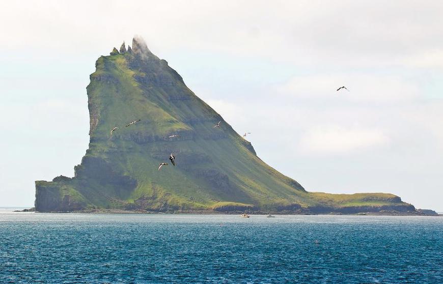
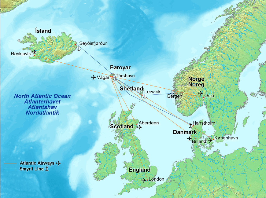
고래 사냥으로 악명 높은 페로 제도로 여행하기 A Trip to the Faroe Islands Alan Taylor Oct 16, 2012 33 Photos In Focus 북대서양에서 노르웨이와 아이슬랜드의 중간 지점에 위치한 페로 제도는 5만여 사람의 고향이다. 거칠고 나무도 없는 다도해(多島海)는 덴마크령으로 8세기 초부터 양과 사람이 살아왔다. 지역 경제는 어업과 해양 산업에 지나치게 의존하고 있다. 독특한 풍경과 위치는 태양, 구름, 초원, 절벽과 바다 사이의 환상적인 빛의 유희(遊戱)로 사진가들을 끌어들인다. 여기에 수집된 것은 최근 몇 년간 페로 제도에서 온 이미지들이다. In the North Atlantic, halfway between Norway and Iceland, the Faroe Islands are home to more than 50,000 people. The rugged, treeless archipelago is part of the Kingdom of Denmark, and has been inhabited by humans (and sheep) since the early 8th century. The local economy relies heavily on fishing and maritime industry. The unique landscape and location attracts photographers with its fantastic play of light between sun, cloud, meadow, cliff, and sea. Collected here are images of the Faroes from recent years. 1. Tindhólmur, a small island in Sørvágsfjørður, a fjord on the west side of Vágoy in the Faroe Islands. Each of the small peaks has its own name: Original here. # 소르빅스피요르드르의 작은 섬 틴드홀므르는 페로 제도(諸島)에 위치한 비고이(Vágoy) 서쪽 면에 있는 피요르드이다. 각각의 작은 봉우리는 고유의 이름이 이츠티, 아르니, 리틀리, 브레이디, 복디이다. 덴마크령 페로 제도의 지도 ♣ 페로 제도는 영국과 아이슬란드, 노르웨이 사이에 있는 대서양의 여러 섬으로 이루어진 제도이다. 1948년 이후 덴마크 왕국의 자치령이 되었으며, 2005년부터는 외교권에 대한 자치권도 가지게 되었다. 페로인이 91.7%로 가장 많으며 덴마크인 5.8%, 아이슬란드인 0.4%, 노르웨이인과 폴란드인이 각각 0.2%로 그 뒤를 따르고 있다. 수도는 토르스하운이다. 토르스하운은 페로 제도의 제일 큰 섬인 스트레이모이 섬에 있다.
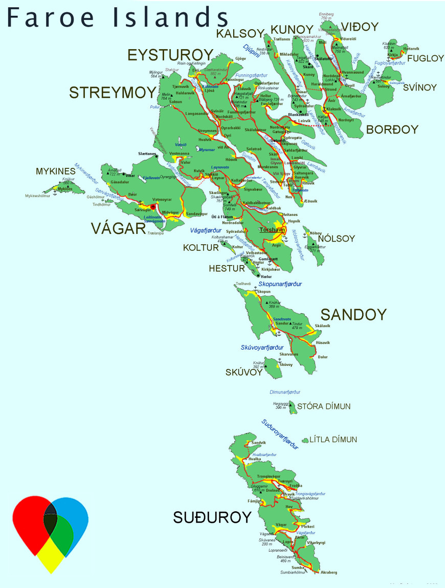
2. The Faroe Islands, as seen from orbit by NASA's Terra and Aqua satellites on April 17, 2003. The archipelago is about 80 km (50 mi) wide, and has a total area of approximately 1,400 sq km (540 sq mi). # 2003년 4월 17일 NASA의 테라(Terra) 위성과 아쿠아 위성(Aqua satellites)의 궤도에서 보여진 페로 제도. 군도(群島)는 약 80km 넓이에 전체 면적은 약 1400㎢(540평방마일)이다.
3. Funningur, a town on the northwest coast of Eysturoy, Faroe Islands. Original here. # 페로 제도, 이스툴로이의 북서부 해안 마을 퍼닝거.
4. Sheep stand in a field in the Faroe Islands. Original here. # 양이 페로 제도의 들판에 서있다.
5. A Faroe Islands village, photographed on April 19, 2011. Original here. #
6. A fisherman tends equipment near Svartaberg. Original here. # 어부가 스바타베르그 인근에서 장비를 점검한다.
7. The harbor of Tórshavn, capital and largest town of the Faroe Islands, photographed from an arriving ferry, on June 23, 2008. Original here. # 페로 제도의 수도(首都)이며 최대 도시 토르스하운(Tórshavn) 항구, 2008년 6월 23일 여객선으로 도착하여 촬영.
8. A horse stands along the coast line of the village of Velbastaour on Streymoy, on October 13, 2012. # 말이 2012년 10월 13일 스트레이모이에 있는 벨바스타우르 마을의 해안선을 따라 서있다.
9. An aerial view of Tindhólmur, off of Vagar Island in the Faroe Islands, on May 25, 2007. # 페로 제도, 바가르 섬의 틴드홀무르의 공중 장면, 2007년 5월 25일.
10. Boats tied up at Fámjin, on Suðuroy, the southernmost island in Faroe Islands. Original here. # 배들이 페로 제도의 최남단 섬 수두로이의 파민에서 묶여있다.
11. A river flows near the road from the village of Velbastaour to Syoradalur on the Faroe Islands, on October 13, 2012. #
12. The sun appears behind sheep at the Kirkjubour village on the Streymoy, on October 16, 2012. # 해가 스트레이모이의 킬큐보유르 마을에서 양 뒤로 나타난다.
13. Mykines, the westernmost island in the Faroe Islands, is shrouded in clouds as seen from the village of Gasadalur, on August 11, 2009. # 페로 제도의 최서단 섬 미키네스가 2009년 8월 11일 가사달루르 마을에서 볼 수 있듯이 구름에 가려져있다.
14. Tourists climb Slave's Edge near Leitisvatn in the Faroe Islands, on May 23, 2007. # 관광객들이 2007년 5월 23일 페로 제도의 레이티스바튼 인근 슬라브 에지(평사면 가장자리)를 등반한다.
15. Visitors exit the caves on the island of Nolsoy in the Faroe Islands, on May 25, 2007. # 탐방객들이 2007년 5월 25일 페로 제도의 놀소이 섬에서 동굴을 빠져나간다.
16. A small herd of sheep on a Faroe Island hillside. Original here. # 페로 제도의 산허리에 있는 양떼.
17. A sheep dog helps round up sheep near the village of Saksun on Streymoy, on October 8, 2007. # 양치기 개(牧羊犬)가 2007년 10월 8일에 스트레이모이의 삭순 마을 인근에서 양 몰이를 돕는다.
18. A woman knits a traditional Faroese wool sweater in Tórshavn, on June 01, 2007. # 한 여자가 2007년 6월 1일 토르하운에서 전통 페로 울 스웨터를 짠다(뜨게질한다).
19. Faroe Islands, June 23, 2008 near Tórshavn. Original here. # 2008년 6월 23일 페로 제도 수도 토르스하운 부근.
20. Inhabitants of Faroe Islands drive pilot whales during their traditional 'Grindadrap' (whale hunt in Faroese) near the capital Tórshavn, on November 22, 2011. Residents of the Faroe Islands, an autonomous province of Denmark, slaughter and eat pilot whales every year. # 페로 제도의 주민들이 2011년 11월 22일 수도 토르스하운 근처에서 그들의 전통 그린다드랍(Grindadrap; 페로어; 고래사냥) 동안 파일럿고래(거두고래속)를 몰고간다. 덴마크 자치주 페로 제도의 주민들은 매년 파일럿고래(거두고래속)를 도살하여 먹는다.
21. Faroe Islanders catch and slaughter pilot whales during the traditional 'Grindadrap' near Tórshavn, on November 22, 2011. Descendents of Vikings, and pilot whales have been a central part of their diet for more than 1,000 years. 'Grindadrap' whaling is not done for commercial purposes, the meat can not be sold and is divided evenly between members of the local community. # 페로 제도의 주민들이 2011년 11월 22일 토르스하운(Tórshavn) 근처에서 전통의 '그린다드랍(고래사냥)' 기간 동안 파일럿고래(거두고래속)를 잡아서 도살한다. 바이킹 후예들은 파일럿고래가 1000여년 동안 그들 식단의 중심을 차지해왔다.
22. Klaksvík, the second largest town in the Faroe Islands, on March 30, 2010. Original here. # 2010년 3월 30일 페로 제도에서 두번째로 큰 도시 클락스빅.
23. View from the ferry, shortly after leaving Tórshavn. Original here. # 토르스하운을 떠난 직후 여객선에서 본 전망.
24. Cages, used by a fish farm, float on the sea next to the village of Fuglafjørður, on May 31, 2007. # 2007년 5월 31일 푸글라피요르드드 마을 바로 옆 바다에 떠있는 양식장으로 사용하는 케이지(가두리).
25. Football is the most popular sport in the Faroe Islands. Original here. #
26. Tjornuvik village, located on Streymoy, photographed on October 14, 2012. #
27. A workman mows the grass roof of a government building near the capital city of Tórshavn, on August 13, 2009. # 한 작업자가 2009년 8월 13일 수도 토르스하운 부근 정부 청사 지붕의 잔디를 깍는다.
28. Mountainside farms in the Faroes. Original here. # 페로 제도의 산비탈 농장.
29. Sundini, the strait between Streymoy and Eysturoy, seen on October 14, 2012. # 2012년 10월 14일에 스트레이모이와 이스투로이 사이 순디니 해협(海峽).
30. A fishing boat returns to the harbor north of the capital Tórshavn, on August 10, 2009. # 어선이 2009년 8월 10일 수도 토르스하운 북부 항구로 돌아온다.
31. Tjørnuvík village, on Streymoy, pictured on October 14, 2012. # 2012년 10월 14일에 찍은 스트레이모이의 티요르누빅 마을.
32. A cliffside view near Gásadalur, Faroe Islands. Original here. # 페로 제도의 가사달루르 근처에서 보이는 절벽.
33. The Island of Koltur, at sunset, seen from Streymoy, near the village of Nororadalur, on October 13, 2012. # 2012년 10월 13일 노로라달루르 마을 근처 스트레이모이에서 볼 수 있듯이 해질무렵에 콜투르 섬. |